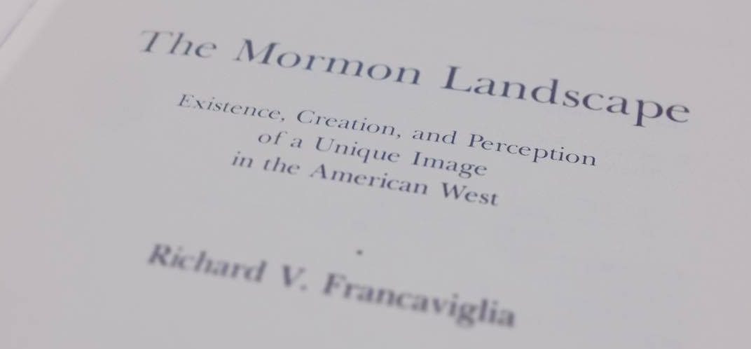
One of the core books on Mormon settlement is The Mormon Landscape by Richard Francaviglia. It examines the distinctive patterns used by Mormons in settling the Western United States. In his research, he examined hundreds of settlements across the intermountain west looking for features that were common to places settled by Latter-day Saints and he was able to define a list of landscape features that were common. Kind of like a Mormon places DNA test.
He makes it very clear that each item, taken on its own, is not unique to Mormon settlements. It is their collective presence as a “visual combination of a series of elements” that creates the unique “Mormon scene.”1
As I have read and referred to this text, my particular interest is in seeing whether these features were carried north to the towns and villages in the Canadian Mormon Trail (Cardston, Magrath, Raymond, Stirling, Barnwell, etc.). Though the Canadian settlements trailed the initial Utah settlement by at least 40 years, many of the earliest settlers in Canada had also been pioneering settlers in Utah. Consider Charles Ora Card as an example. At 16, less than 10 years after Brigham Young first led the Saints to the Salt Lake Valley, he trekked to Utah from Michigan with his parents and eventually settled in Farmington. As the first settlements in Utah began to fill up, his family was among the first settlers to move north to the Cache Valley in present-day Logan.2 By the time he led a company to Canada in 1887, he was an experienced pioneer. So it shouldn’t be surprising to see those early Canadian settlers bring the Mormon landscape with them north.
Though there are more than 10 features covered through the book, “ten of the most significant factors can be used in delimiting Mormon settlement.” According to Francaviglia, any town “possessing more than five of these will be a Mormon town.” The ten factors are:
- wide streets (65 feet or wider)
- roadside irrigation ditches
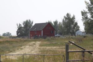
- barns and granaries inside of town
- open landscape around the town
- architectural style (especially the central-hall house)
- high percentage of brick homes
- the hay derrick
- the Mormon fence
- unpainted farm buildings
- the LDS chapel
If you live or have lived in a Mormon town in Southern Alberta, stop and look around. Can you see at least five of these features? Perhaps you’ll be as thrilled as I was to recognize the Mormon towns of Southern Alberta in its pages.
There is context and history behind many of these features. Joseph Smith envisioned a settlement that blended urban and rural, secular and religious. He called it the Plat of Zion. Town lots were large to accommodate gardens, animals and barns. Every resident could have a mini farm right inside the town while they maintained a full farm outside. It provided a level self-sufficiency that would be completely foreign, and likely illegal, in most modern communities. It was framed with wide streets and in its core, the chapel and other public buildings created a gathering place.
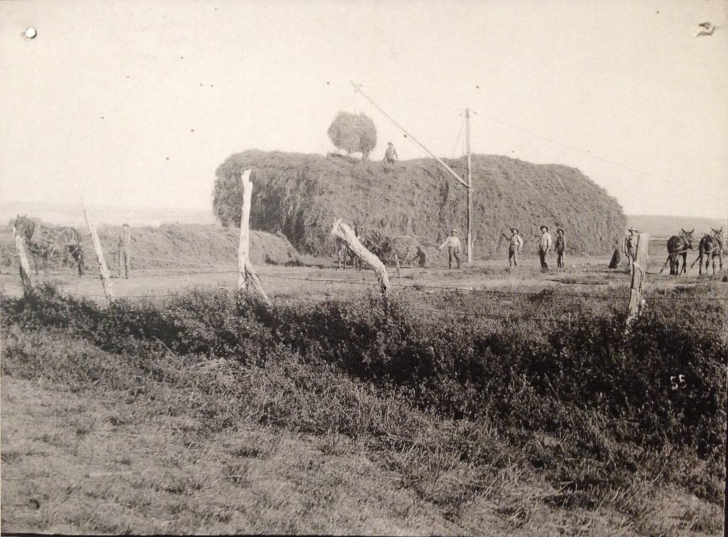
Other features were later additions. Irrigation was added in Utah by necessity. Mormon expertise in the practice paved the way for their settlement in Southern Alberta. The hay derrick was a Western Mormon innovation.3 Practicality led to simple but functional fences and unpainted outbuildings. Together it tells the story of a people.
I couldn’t help but feel nostalgic as I read the book. As time progresses many of these features are being erased from our landscape in Southern Alberta. Agricultural practices in many of these towns have been restricted or removed through bylaws.4 Barns and outbuildings are falling into disrepair through disuse, eventually, most will be removed. The hay derrick has been replaced by modern machinery. Large lots are subdivided. Pioneer homes are removed. It is a window into the past that is being closed.
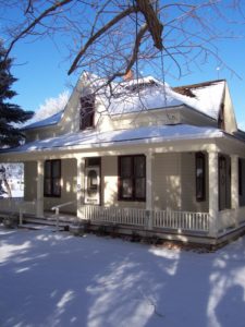
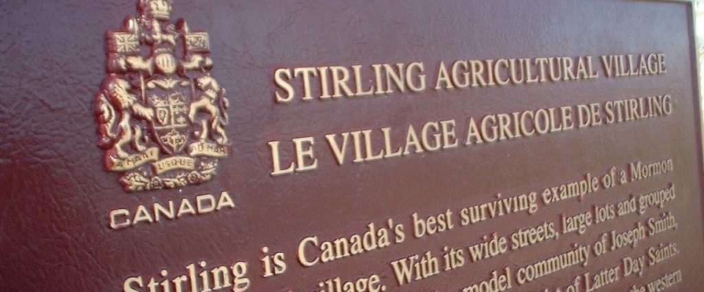
Luckily there are still places where you can see many of these things. If you haven’t visited the Michelson Farmstead in Stirling, you need to. It is a protected example of this urban-rural blend. I imagine there are still other examples, though not explicitly protected, in the smaller Mormon communities in the region.
If you are looking for a book that will help you see what makes this region unique, this is the one. I love this book. It is thorough and includes enough charts and maps to satisfy my most nerdy parts. If you see me driving around slowly looking out the car window, or walking the streets and looking at old houses or fences, you’ll now know what I’m looking for. I’m looking through a window into the past.
In future posts, I hope to explore many of these features in more depth. Can you think of features of the Canadian Mormon settlements that you’d add to the list? Are there items from Francaviglia’s ten that you wouldn’t include in your Canadian top ten?
—
This post is adapted from a Facebook post I wrote soon after reading the book for the first time.
- Francaviglia RV. The Mormon Landscape. Ams Press Inc.; 1978. [↩]
- Hudson AJ. Charles Ora Card, Pioneer and Colonizer. 1963. [↩]
- Francaviglia RV. Western Hay Derricks: Cultural Geography and Folklore as Revealed by Vanishing Agricultural Technology. Journal of Popular Culture. 1978;11(4):916-927. [↩]
- For example, Raymond’s Land Use Bylaw restricts agriculture practices and certain livestock to approved areas. http://cms.raymond.ca/Editor/images/Bylaw%20987-11%20Land%20Use%20Bylaw.pdf. [↩]